PARGE® Image Rectification
PARGE: Overview | Background | Features | Method | Results | Screenshots
Parametric Geocoding & Orthorectification for Airborne Optical Scanner Data
PARGE® is the orthorectification and direct geocoding software for airborne optical scanner data. It performs an ortho-rectification of line scanner imagery using a digital elevation model on the basis of high precision flight parameters such as GPS position and attitude angles. Using accurate digital elevation models and optional ground control points, sub-pixel geometric accuracy is achieved. The program is suited for the correction of all kinds of airborne scanner imagery and is optimized for airborne hyperspectral instruments. Directly supported sensors are: NEO HYSPEX and Mjolnir, Specim AISA Fenix/AFX-10/AFX-17, Itres CASI/SASI/TASI, Hyvista HyMap, Resonon Pika, Corning Shark, Headwall Hyperspec, and more.
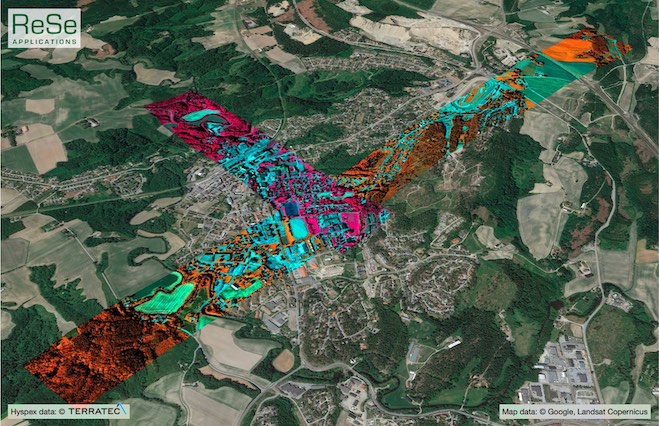
Mysen (NO) stripes overlay (Hyspex VNIR1800) © Daniel Schläpfer, ReSe, 2020, © original data by Terratec, Norway.
Key Capabilities
The software offers these key advantages:
- direct parametric geocoding & orthorectification,
- semi-automatic, and fully automatic boresight calibration procedures
- optimization for pushbroom imaging spectroscopy (hyperspectral data)
- a workbench-style graphical user interface
- open internal data format
- full batch processing support
- wide variety of resampling options
- support for raw-geometry based processing chains
- automatic mosaicking
- direct link to atmospheric correction packagse (ATCOR-4 and DROACOR)
- customer-oriented software customization
For more information please visit: parge.com


